
Fully Managed FacilMap
as a Service
Deploy FacilMap as a fully managed service starting at €9/mo. Get automated backups, SSL, updates, support and monitoring included.
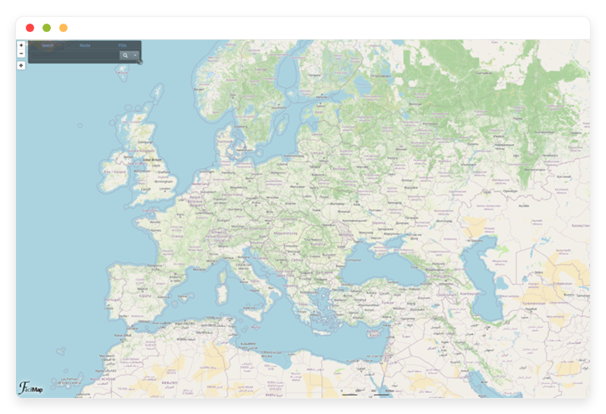
FacilMap is an open-source collaborative mapping tool: search places, plan routes with elevation, and add markers, lines, and custom layers to shared maps. It combines the live collaboration of Google My Maps with the privacy and control of self-hosted infrastructure built on OpenStreetMap data.
✓Free 7-day trial ✓99.9% Uptime SLA ✓No credit card ✓Cancel anytime
✓Free 7-day trial ✓99.9% Uptime SLA
✓No credit card ✓Cancel anytime

FacilMap
STARTING AT
USAGE
 Germany
 Finland
 Netherlands
 UK
 Sweden
 United States
 Canada
 Singapore
 Japan
 Australia
 Brazil
 South Africa+9 more →
ABOUT THE SOFTWARE
What is FacilMap
FEATURES
What FacilMap does
WHAT'S ALWAYS INCLUDED
Every app. Fully managed.
Nothing extra to pay for.
Every app on DANIAN ships with the same operational baseline. You do not choose a backup add-on or a monitoring tier. Hosting, patching, backups, SSL, and support are part of the €9, and they apply to FacilMap the same way they apply to everything else in the catalog.
WHY MANAGED
Why teams pick managed FacilMap
REVIEWS
Hear from customers like you

No more maintenance headaches!
Finally, I can relax and not bother with maintenance. Each of the softwares that we run on DANIAN is automated and running stable for couple months already. They even assist us with modifying the DNS records. Once we needed to modify the config of Nextcloud so that we are able to upload higher than 5GB files and they assisted us fast. I also love their documentation!

Kevin Blackwell

Best managed service
I previously ran Peertube, Mastodon, Mattermost and Mirotalk on other providers before switching to DANIAN. I was tired of handling the updates and backups myself. Not only that the performance is "out of this world" fast, but their tech support is amazing. Since then I added 5-10 more Apps on my account. I also love how they add more softwares on their list constantly!

William Northfield

Love the personalized service!

George Adams
n8n runs excellent

David Hartmann

Smooth experience
I needed a way to manage the projects and files for my company. This was the first time I learn about opensource. I asked their support team and they assisted me immediately. I started with Openproject. Later I added Nextcloud. My team were able to get used to the apps fast.

Levi Nilsson

Bye GA

Wyatt Mitchell

Love the freedom
I wanted to use a crm for my startup. I signed up for the free trial. Tried out espocrm and dolibar and picked one. Their dashboard is very easy for a beginner. I recommend them and feel confident in choosing them.

Elias Koch
Wow just wow
After discovering DANIAN, I wished I'd found them sooner — their solution is excellent and deserves wider recognition. Very good solution!

Tyler Hollander
Professional tech support!

Bastian Engel
Their support team is the best!
I had a problem with my card and the subscription could not be renewed in time. I notified their support and surprisingly, they showed much understanding. They basically left my apps run until I solved the card issue. Other providers would have deleted my data in a heartbeat. This is the way to build client-vendor trust!
George Adams
Fair price and fast
4 months ago I activated n8n, Uptime kuma, Vaultwarden and Paperlessngx. So far everything is perfect. The performance of all apps is excellent. I contacted their support team couple times for using custom subdomains for the apps and they were fast and kind. I'm constantly recommending them to my network!

Atanas

Vaultwarden 10/10
I wanted to selfhost a passwords manager for my company but I didn't trust the mainstream providers. I tried out Vaultwarden for the free trial. I loved how their support team communicated with me professionally but still kind. I know that I can contact them whenever with whatever question I have. Recommended!

James Smith
Multiple locations options

Edward Nelson
Everything just works!
My focus is on my business, not running servers. I love that I can lauch any app without having to think about the tech behind it. Everything just works!

Tony Roy
Awesome support team!

Filip

Very proactive!
Today couple of the videos on my Peertube got viral. Before I even noticed, their support have notified me via email that they proactively upgraded my app with more cpu & ram so that it continues to work without any downtime. They left the upgraded app with the added resources for couple days until the traffic stabilizes. After that I had the possiblity to stay on the same plan or keep the upgraded plan. Out of gratitude I stayed on the upgraded one.

Luke Hall

Win-win!
I run a web design biz. After I perform the work for my clients, they constantly ask me for more software solutions. So I partnered with DANIAN. Not only I provide the requested softwares for my clients and get the increased revenue boost by delegating all to DANIAN, but also for those clients that wish to order directly from DANIAN, I send them an affiliate link. Win-win on all sides!

Luke Walker

Jeffrey Johnson
Awesome customer service
I needed to add analytics on my website but I didn't know anything about DNS. Their team guided me at all phases and they performed the changes for me. Additionally they were transparent and notified me of every change applied and steps performed.

Gabriele Marino

Good admin dashboard
Not only that I got Chatwoot, I also have access to the management dashboard. I love that I can view my hourly/daily usage and perform manual backups and restorations if needed. I don't need the level of control but it feels good to know that I have it if I need it.

Matthew Turner

Andreas Schmitt
Great service!
I configure custom Matomo tracking for my clients as a monthly service. Many of my clients were asking if they can selfhost Matomo instead of using the Cloud service. My employee recommended DANIAN. Basically, I can activate as much Matomo's in any of 20+ countries the same day. Additionally the affiliate revenue is a nice bonus.

Jacob Turner
Smooth experience
I was listing through youtube tuts on how to install Bookstack myself. Then randomly, I found their video playlist exactly for Bookstack. Got curious and went at their website. For the same price (or higher) that I would pay for just the VPS, with them I'm getting a fully managed Bookstack. It's a no-brainer decision!

Elias Gustafsson


Mason Hayes
Its a great service
Its a great service. I love the performance of my Mastodon community. It keeps on growing and I don't have any worries about backups, secuirity, updates, etc.

Vinícius Rocha

Very intuitive solution!
I wanted to use a nocode software for my company. A friend recommended them so I tried both Baserow and NocoDB, couple days later picked one.

Haruto Hashimoto


Henrik Otto
USE CASES
Three teams who run FacilMap on DANIAN
FacilMap fits any team that needs several people building one map together. Three patterns come up most often: outdoor groups planning routes, event crews mapping a site, and tourism teams publishing a public points-of-interest map.
HIKING & CYCLING CLUB
Planning a weekend route together on a Friday call
Five club members open the editable link during a video call and drag the route to skirt a closed trail, watching the elevation profile update. One exports a ZIP of per-route GPX files to a handheld GPS; the others bookmark the read-only link on their phones. Base layers: OpenTopoMap and Hike & Bike.
EVENT PRODUCTION TEAM
Mapping stages, generators, and first-aid points
The site lead holds the admin link and defines custom marker types (stage, generator, first-aid), each with capacity and contact fields. Vendor coordinators get the editable link; security and press get the read-only link. The map is embedded as an iframe on the event intranet, filtered by saved views per department.
TOURISM BOARD
A public 'things to do' map three staff maintain
Three communications staff co-edit the official points-of-interest map, switching between street and topographic layers and grouping markers by category. The director keeps the admin link; the team shares the editable link; a read-only iframe is published on the destination website, rebranded with the board's name and styling.
COMPARISON
Four ways to run FacilMap
FacilMap itself has no paid seats: a map can have as many editors as you share the link with. So the real question is what it costs to keep the software and its map services running. Here are four paths, with the monthly cost at one, five, and ten people.
| How you run it | 1 person | 5 people | 10 people | Ongoing work |
|---|---|---|---|---|
| Proprietary mapping SaaS | $110/mo | $220/mo | ~$417/mo | None, but charged per seat, billed annually, not self-hostable, and your data lives in their cloud. |
| Self-host on a VPS | ~$24/mo | ~$24/mo | ~$24/mo | 1–2 hrs/month: you run the database, private geocoding, and the routing and tile tokens yourself. |
| Home server | €650–1,500 once + €17–32/mo | same | same | 2–4 hrs/month, plus business internet, a static IP, and an off-site backup target. |
| DANIAN managed FacilMap | €9/mo | €9/mo | €9/mo | None: we run the map services, backups, updates, and monitoring. |
Proprietary SaaS figures use Maptive Pro and Team pricing, billed annually; the 10-person figure adds five additional licences. The VPS path assumes a $24/month, 2 vCPU / 4 GB production-class server plus your own map-service keys. Home-server hardware is amortised over 36 months at standard metered electricity rates.
At one person, the proprietary path costs roughly twelve times the managed FacilMap price. At ten, the gap widens, because that path charges per seat while the others do not. The self-host and home-server paths look cheaper than the SaaS on the sticker, but the monthly figure leaves out the hours you spend keeping the map services running.
BY INDUSTRY
FacilMap for specific industries
Different fields put different demands on a shared map. These four use FacilMap in ways that shape how we configure it: the base layers we default to, the routing profiles we preset, and the export formats their downstream tools expect.
FAQ
Frequently asked questions
Three groups of questions below. The first covers how FacilMap works and how we configure it. The second covers moving your existing maps and domain in. The third covers billing, support, and how the platform works across every app we host.
01
Technical and configuration
02
Migration and onboarding
03
Billing, support, and platform
DEPLOY IN YOUR REGION
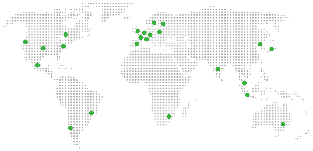
21 datacenter locations on six continents
Pick the region closest to your users.
United States, Germany, Finland, Singapore, Australia, Brazil, Canada, Netherlands, UK, Spain, Italy, France, Sweden, Malaysia, India, Japan, Mexico, Poland, South Korea, Chile, South Africa and more coming soon
Try managed FacilMap for 7 days
SERVICES
COMPANY
RESOURCES
COMPARE


